


15 Tuckers Cross Roads School Voting District, Wilson County, Tennessee
About
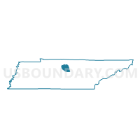
Outline

Summary
| Unique Area Identifier | 670046 |
| Name | 15 Tuckers Cross Roads School Voting District |
| County | Wilson County |
| State | Tennessee |
| Area (square miles) | 27.26 |
| Land Area (square miles) | 27.26 |
| Water Area (square miles) | 0.00 |
| % of Land Area | 100.00 |
| % of Water Area | 0.00 |
| Latitude of the Internal Point | 36.20897570 |
| Longtitude of the Internal Point | -86.15656950 |
Maps


Graphs
Select a template below for downloading or customizing gragh for 15 Tuckers Cross Roads School Voting District, Wilson County, Tennessee


Neighbors
Neighoring Voting District (by Name) Neighboring Voting District on the Map
- 03 New Middleton Voting District, Smith County, TN
- 04 Rock City Voting District, Smith County, TN
- 07 Shop Springs Baptist Church Voting District, Wilson County, TN
- 07 Watertown High School Voting District, Wilson County, TN
- 09 Commerce Cumberland Pres. Church Voting District, Wilson County, TN
- 15 Full Gospel Tabernacle Voting District, Wilson County, TN
- 20 Market Street Community Center Voting District, Wilson County, TN
- 21 Water & Wastewater Auth. Of Wilson Co. Voting District, Wilson County, TN
Top 10 Neighboring County Subdivision (by Population) Neighboring County Subdivision on the Map
- District 15, Wilson County, TN (4,086)
- District 7, Wilson County, TN (4,044)
- District 20, Wilson County, TN (3,940)
- District 21, Wilson County, TN (3,911)
- District 9, Wilson County, TN (3,876)
- District 3, Smith County, TN (2,667)
- District 4, Smith County, TN (2,534)
Top 10 Neighboring Elementary School District (by Population) Neighboring Elementary School District on the Map
Top 10 Neighboring Secondary School District (by Population) Neighboring Secondary School District on the Map
Top 10 Neighboring Unified School District (by Population) Neighboring Unified School District on the Map
Top 10 Neighboring State Legislative District Lower Chamber (by Population) Neighboring State Legislative District Lower Chamber on the Map
Top 10 Neighboring State Legislative District Upper Chamber (by Population) Neighboring State Legislative District Upper Chamber on the Map
Top 10 Neighboring 111th Congressional District (by Population) Neighboring 111th Congressional District on the Map
Top 10 Neighboring Census Tract (by Population) Neighboring Census Tract on the Map
- Census Tract 301.02, Wilson County, TN (6,640)
- Census Tract 308, Wilson County, TN (5,787)
- Census Tract 310, Wilson County, TN (5,662)
- Census Tract 9752, Smith County, TN (5,634)
- Census Tract 307, Wilson County, TN (3,383)